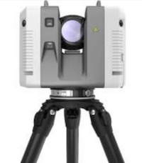
3D laser scanners are also known as LiDAR scanners that capture site measurements as point cloud data. This data is then used throughout the project to create 2D drawings, 3D sitemaps and 3D models, to be used in design, planning and project calculations.
3D laser scanning does not replace a team of engineers, planners and project managers but it does provide them with accurate and important information to make informed decisions faster.
The accurate site data collected is used as direct inputs into surveying, topographical mapping, engineering and 3D modelling processes.
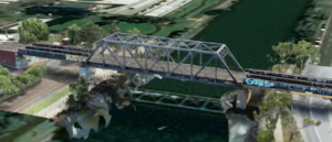
3D laser scanning is also used to capture as built structures, objects or wide spaces such as bridges, buildings and quarries along with construction sites. These laser scanners measure lasers in 360 degrees and gather millions of measurements per minute to create a 3D replica of the scanned environment in digital space.
Depending on your project needs, these 3D laser scanners can scan objects up to several hundred meters away with extreme accuracy. 3D laser scanning can be conducted from planes, vehicles, drones or on the ground.
Digital Visualisation
Digital Visualisation
In most cases multiple scans are required to cover the target area. These different scans are not saved as different point cloud images but are later combined to create a single point cloud and then converted into a precise 3D model.
Benefits of 3D Laser Scanning
3D laser scanning may seem more complicated than conventional surveying and you will need surveying or geo-spatial expertise to ensure data quality and accuracy. You will also need 3D modelling experience to process, export and convert the point cloud to precision 3D models.
Don’t let the idea of new technology or a different cost model deter you, because the benefits of 3D laser scanning far outweigh the costs, and Avian Australia have industry-specific expertise that take the hassles out of the process.
Here are some advantages of 3D laser scanning:
- Better design and project planning– The 3D models created allow site engineers and planners to better visualise how the build form / paths / roadway / construction looks on the ground and in relation to each other.
- More accurate dimensions– help determine the basic shape, size and structure of the project. 3D scanners also help designers detect errors in the design and resolve them in the conceptual stage. This saves a lot of time, reduces waste and eliminates the need for costly rectification and rework.
- Improved safety– With laser scanning, surveyors can reach spaces on the construction site that would have been otherwise inaccessible if walking the site. You don’t have to risk the safety of workers, making them walk on unstable ground, enter deep excavations or crawl inside tight spaces.
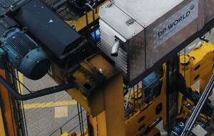
Asset Inspection
- Reduced asset inspection costs – engineers can detect structural damages and confidently plan repairs and maintenance.
- Reduced Time – 3D laser scanners take around half the time needed to survey a site when compared to manual surveying methods.
- Reduced Time – 3D laser scanners take around half the time needed to survey a site when compared to manual surveying methods.
- Reduced Cost– we estimate you can reduce total project costs by between 10-17%.
- Collaboration and Integration into all disciplines of the project– 3D laser scanning data is easily integrated into your project and existing workflow.
- With everyone using the same data for estimates and calculations that is easily shared amongst project teams.
- Improved stakeholder relations– 3D modelling and digital visualisation makes your designs “sellable”. It helps engineers and project managers create interactive presentations to get designs approved and obtain stakeholder buy-in to get everyone on board with the project.